pygmt.Figure.wiggle
-
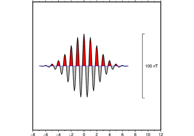
Figure.wiggle(x=None, y=None, z=None, data=None, **kwargs)¶ Plot z=f(x,y) anomalies along tracks.
Takes a matrix, (x,y,z) triplets, or a file name as input and plots z as a function of distance along track.
Must provide either
dataorx/y/z.Full parameter list at https://docs.generic-mapping-tools.org/latest/wiggle.html
Aliases:
B = frame
D = position
G = color
J = projection
R = region
T = track
U = timestamp
V = verbose
W = pen
X = xshift
Y = yshift
Z = scale
c = panel
i = columns
p = perspective
- Parameters
x/y/z (1d arrays) – The arrays of x and y coordinates and z data points.
data (str or 2d array) – Either a data file name or a 2d numpy array with the tabular data. Use parameter
columnsto choose which columns are x, y, z, respectively.projection (str) – Required if this is the first plot command. projcode[projparams/]width. Select map projection.
region (str or list) – Required if this is the first plot command. xmin/xmax/ymin/ymax[+r][+uunit]. Specify the region of interest.
scale (str or float) – Gives anomaly scale in data-units/distance-unit. Append c, i, or p to indicate the distance unit (cm, inch, or point); if no unit is given we use the default unit that is controlled by PROJ_LENGTH_UNIT.
frame (bool or str or list) – Set map boundary frame and axes attributes.
position (str) – [g|j|J|n|x]refpoint+wlength[+jjustify][+al|r][+odx[/dy]][+l[label]]. Defines the reference point on the map for the vertical scale bar.
color (str) – Set fill shade, color or pattern for positive and/or negative wiggles [Default is no fill]. Optionally, append +p to fill positive areas (this is the default behavior). Append +n to fill negative areas. Append +n+p to fill both positive and negative areas with the same fill. Note: You will need to repeat the color parameter to select different fills for the positive and negative wiggles.
track (str) – Draw track [Default is no track]. Append pen attributes to use [Default is 0.25p,black,solid].
Select verbosity level [Default is w], which modulates the messages written to stderr. Choose among 7 levels of verbosity:
q - Quiet, not even fatal error messages are produced
e - Error messages only
w - Warnings [Default]
t - Timings (report runtimes for time-intensive algorithms);
i - Informational messages (same as
verbose=True)c - Compatibility warnings
d - Debugging messages
pen (str) – Specify outline pen attributes [Default is no outline].
xshift (str) – [a|c|f|r][xshift]. Shift plot origin in x-direction.
yshift (str) – [a|c|f|r][yshift]. Shift plot origin in y-direction. Full documentation is at https://docs.generic-mapping-tools.org/latest/gmt.html#xy-full.
panel (bool or int or list) – [row,col|index]. Selects a specific subplot panel. Only allowed when in subplot mode. Use
panel=Trueto advance to the next panel in the selected order. Instead of row,col you may also give a scalar value index which depends on the order you set viaautolabelwhen the subplot was defined. Note: row, col, and index all start at 0.columns (str or 1d array) – Choose which columns are x, y, and z, respectively if input is provided via data. E.g.
columns = [0, 1, 2]orcolumns = "0,1,2"if the x values are stored in the first column, y values in the second one and z values in the third one. Note: zero-based indexing is used.perspective (list or str) – [x|y|z]azim[/elev[/zlevel]][+wlon0/lat0[/z0]][+vx0/y0]. Select perspective view and set the azimuth and elevation angle of the viewpoint. Default is [180, 90]. Full documentation is at https://docs.generic-mapping-tools.org/latest/gmt.html#perspective-full.